|
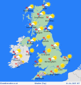
 Wednesday Wednesday
A breezy morning for much of England and Wales. There will be some broken cloud but also plenty of sunshine. Feeling chilly in the wind. Much lighter winds in Scotland and Ireland with good spells of sunshine here. Staying fair into the afternoon with more sunny spells and dry weather. Remaining breezy in the south. Highs at 14 to 17C but just 12C on eastern coasts.
 Wednesday Night Wednesday Night
Breezy tonight in England and Wales. Broken cloud again, but some clear spells roo. Dry in Scotland and Ireland, mostly clear skies here too. Lows at 1C in central Scotland, 6C in eastern and southern England.
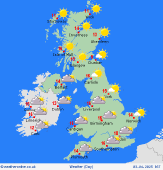
 Thursday Thursday
High pressure north of Scotland on Thursday. Breezy again in England and Wales as well as Ireland. Cloud increasing in central and southern England, Wales and Ireland with outbreaks of rain breaking out across the southwest. Not much change into the afternoon with most places dry with sunny spells, the best in Scotland. Highs at 14 to 16C although a cold 12C on eastern coasts.
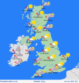
 Friday Friday
High pressure remains north of Scotland on Friday. A fresh easterly flow covers the British Isles. Plenty of sunshine for most areas and staying dry. The afternoon is going to be dry too with more sunshine toc ome. Only small amounts of cloud floating around. Highs at 15 to 18C.
|


